Broughty Ferry
Introduction
The photograph on this page of Broughty Ferry by David Dixon as part of the Geograph project.
The Geograph project started in 2005 with the aim of publishing, organising and preserving representative images for every square kilometre of Great Britain, Ireland and the Isle of Man.

There are currently over 7.5m images from over 14,400 individuals and you can help contribute to the project by visiting https://www.geograph.org.uk
Broughty Ferry
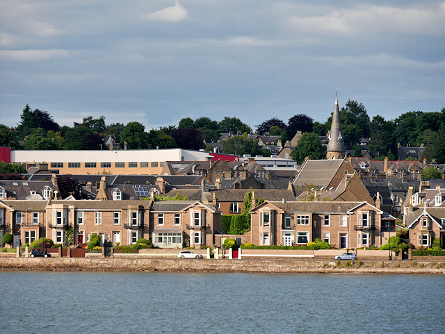
Image: © David Dixon Taken: 8 Jul 2016
Broughty (Brochtie) Ferry is a suburb of Dundee situated four miles east of the city centre on the north bank of the Firth of Tay. Formerly a prosperous fishing and whaling village, the area was a separate burgh from 1864 until 1913, when it was incorporated into Dundee (https://en.wikipedia.org/wiki/Broughty_Ferry Wikipedia). In this photograph, the prominent landmark is the spire of St Stephen's Church behind the waterfront.
Images are licensed for reuse under creativecommons.org/licenses/by-sa/2.0
Image Location
Latitude
56.467275
Longitude
-2.882082