Kennet House and St Laurence's Church
Introduction
The photograph on this page of Kennet House and St Laurence's Church by Ian Capper as part of the Geograph project.
The Geograph project started in 2005 with the aim of publishing, organising and preserving representative images for every square kilometre of Great Britain, Ireland and the Isle of Man.

There are currently over 7.5m images from over 14,400 individuals and you can help contribute to the project by visiting https://www.geograph.org.uk
Kennet House and St Laurence's Church
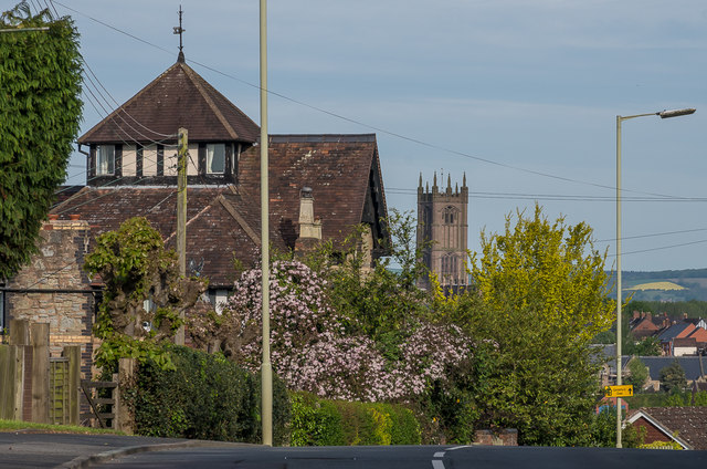
Image: © Ian Capper Taken: 19 May 2016
A telephoto shot of Kennet House on Sheet Road, with the tower of St Laurence's Church in the background. Kennet House dates from 1872 and is reputed to have been built for a railway official who wanted to look down on the railway. It is grade II listed - see https://www.historicengland.org.uk/listing/the-list/list-entry/1212017.
Images are licensed for reuse under creativecommons.org/licenses/by-sa/2.0
Image Location
Latitude
52.365492
Longitude
-2.70342