Pokesdown: Stourvale Place and Cromwell Place meet
Introduction
The photograph on this page of Pokesdown: Stourvale Place and Cromwell Place meet by Chris Downer as part of the Geograph project.
The Geograph project started in 2005 with the aim of publishing, organising and preserving representative images for every square kilometre of Great Britain, Ireland and the Isle of Man.

There are currently over 7.5m images from over 14,400 individuals and you can help contribute to the project by visiting https://www.geograph.org.uk
Pokesdown: Stourvale Place and Cromwell Place meet
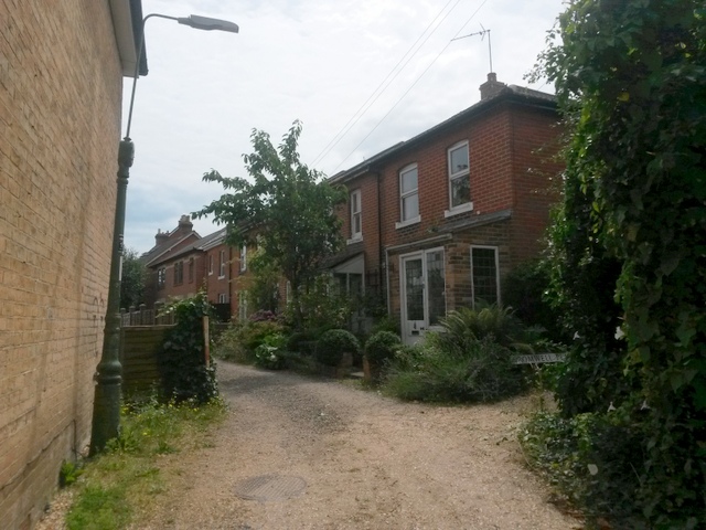
Image: © Chris Downer Taken: 21 Jul 2016
Stourvale Place is a little gravel lane off Stourvale Road, which has a few houses along it (seen ahead). It forms public footpath number G08 and turns a corner to come out on Wyncombe Road. Another path, Cromwell Place, comes out on the right - the name sign can be seen among the undergrowth. See: Image for the next view along Stourvale Place, ahead; Image for the next view along Cromwell Place, right; and Image for the view along here from just behind us. The first two links give further links to photos along each route.
Images are licensed for reuse under creativecommons.org/licenses/by-sa/2.0
Image Location
Latitude
50.730542
Longitude
-1.82227