Throop: Cassel, Careys Road
Introduction
The photograph on this page of Throop: Cassel, Careys Road by Chris Downer as part of the Geograph project.
The Geograph project started in 2005 with the aim of publishing, organising and preserving representative images for every square kilometre of Great Britain, Ireland and the Isle of Man.

There are currently over 7.5m images from over 14,400 individuals and you can help contribute to the project by visiting https://www.geograph.org.uk
Throop: Cassel, Careys Road
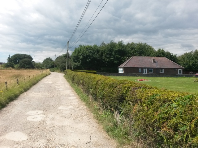
Image: © Chris Downer Taken: 16 Jul 2016
Cassel is the name of the bungalow on the right but is almost too generously named on the 1:25,000 map to refer only to that. I am not sure if the garden to the immediate right belongs to it - there is a wall between them but it doesn't obviously belong to another house. We are looking along Careys Road, which is a byway open to all traffic (or B.O.A.T.), number K25. It has a few properties dotted along it - some named, some numbered seemingly randomly in the mid 50s. See Image for the next view on the road ahead, and Image for a view behind us.
Images are licensed for reuse under creativecommons.org/licenses/by-sa/2.0
Image Location
Latitude
50.759537
Longitude
-1.849807