?Homes Fit for Heroes? Dagenham
Introduction
The photograph on this page of ?Homes Fit for Heroes? Dagenham by Glyn Baker as part of the Geograph project.
The Geograph project started in 2005 with the aim of publishing, organising and preserving representative images for every square kilometre of Great Britain, Ireland and the Isle of Man.

There are currently over 7.5m images from over 14,400 individuals and you can help contribute to the project by visiting https://www.geograph.org.uk
?Homes Fit for Heroes? Dagenham
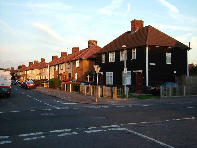
Image: © Glyn Baker Taken: 7 Sep 2005
This is the junction of Rogers Rd and Holgate road Dagenham. The picture is looking down Holgate Road. These are typical examples of the housing on the Becontree Estate. Initially 25000 homes were built by the London County Council between 1921 and 1934. These homes fit for the heroes of WW1 had all mod cons gas, water and electricity with inside toilets and bathrooms. A further 2000 homes were built before WW2. The Becontree estate was the biggest council estate in the world. Of course much of it has been sold off. The houses on the estate were almost universally pebble dashed to cover up inferior bricks. You can spot the houses still in public ownership in this particular area of the estate as the council has taken to weatherboarding them.
Images are licensed for reuse under creativecommons.org/licenses/by-sa/2.0
Image Location
Latitude
51.544152
Longitude
0.15164