St. Olave's churchyard, Seething Lane, 1988
Introduction
The photograph on this page of St. Olave's churchyard, Seething Lane, 1988 by Robin Webster as part of the Geograph project.
The Geograph project started in 2005 with the aim of publishing, organising and preserving representative images for every square kilometre of Great Britain, Ireland and the Isle of Man.

There are currently over 7.5m images from over 14,400 individuals and you can help contribute to the project by visiting https://www.geograph.org.uk
St. Olave's churchyard, Seething Lane, 1988
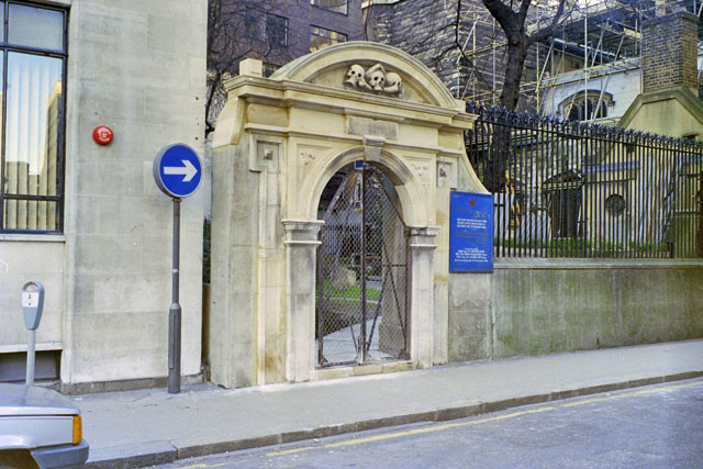
Image: © Robin Webster Taken: Unknown
As a small boy in the late 40s and early 50s being walked from Fenchurch Street to Tower Hill stations, this was passed with great trepidation. It was worse coming back in the dark. The skulls were the thing. I am not sure I like them even now.
Images are licensed for reuse under creativecommons.org/licenses/by-sa/2.0
Image Location
Latitude
51.510665
Longitude
-0.079514