Wallisdown: western end of footpath U18
Introduction
The photograph on this page of Wallisdown: western end of footpath U18 by Chris Downer as part of the Geograph project.
The Geograph project started in 2005 with the aim of publishing, organising and preserving representative images for every square kilometre of Great Britain, Ireland and the Isle of Man.

There are currently over 7.5m images from over 14,400 individuals and you can help contribute to the project by visiting https://www.geograph.org.uk
Wallisdown: western end of footpath U18
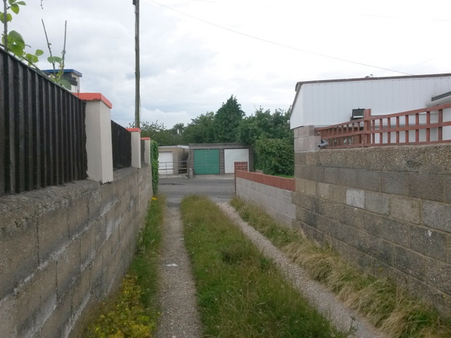
Image: © Chris Downer Taken: 12 Jul 2016
This public footpath is essentially a rear garage driveway for houses in Canford Avenue and Walliscott Road. Given the height of the grass down the middle, it is perhaps not very heavily used as a driveway. See Image for the view along the driveway from across the road, and Image for the next view behind us.
Images are licensed for reuse under creativecommons.org/licenses/by-sa/2.0
Image Location
Latitude
50.749709
Longitude
-1.912916