West Howe: derelict something on footpath U01
Introduction
The photograph on this page of West Howe: derelict something on footpath U01 by Chris Downer as part of the Geograph project.
The Geograph project started in 2005 with the aim of publishing, organising and preserving representative images for every square kilometre of Great Britain, Ireland and the Isle of Man.

There are currently over 7.5m images from over 14,400 individuals and you can help contribute to the project by visiting https://www.geograph.org.uk
West Howe: derelict something on footpath U01
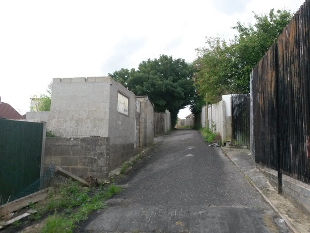
Image: © Chris Downer Taken: 12 Jul 2016
Looking along the rear garage driveway between Turbary Park Avenue (right) and Maclean Road. Public footpath U01 makes use of the driveway, with an alley to Maclean Road just ahead and a path to Turbary Park Avenue a short distance behind us. The alleyway to Maclean Road is just ahead, opposite the lamppost. A similar public footpath route, number U02, heads up the driveway in the background. On the left is a derelict building - I'm not sure what it was, or whether it was municipal or belongs to the house whose back garden it is in. See Image for the next view along the driveway ahead, and Image for the next view behind us - each with further links to photos on the mentioned routes.
Images are licensed for reuse under creativecommons.org/licenses/by-sa/2.0
Image Location
Latitude
50.755649
Longitude
-1.918575