Westbourne: footpath A01 to Warren Road
Introduction
The photograph on this page of Westbourne: footpath A01 to Warren Road by Chris Downer as part of the Geograph project.
The Geograph project started in 2005 with the aim of publishing, organising and preserving representative images for every square kilometre of Great Britain, Ireland and the Isle of Man.

There are currently over 7.5m images from over 14,400 individuals and you can help contribute to the project by visiting https://www.geograph.org.uk
Westbourne: footpath A01 to Warren Road
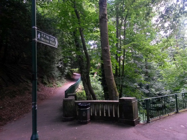
Image: © Chris Downer Taken: 14 Jul 2016
This footpath climbs the side of Alum Chine (at a gentle gradient, as we are already well above the floor of the chine) towards Warren Road. We stand at its eastern end, where it joins the various paths through the chine, which are not designated as public rights of way but are freely usable as they are on public land anyway. See Image for the view towards us down the path, and links to further pictures along the route.
Images are licensed for reuse under creativecommons.org/licenses/by-sa/2.0
Image Location
Latitude
50.717238
Longitude
-1.902494