Progress of 45, Granville Road, St Margaret?s Bay
Introduction
The photograph on this page of Progress of 45, Granville Road, St Margaret?s Bay by John Baker as part of the Geograph project.
The Geograph project started in 2005 with the aim of publishing, organising and preserving representative images for every square kilometre of Great Britain, Ireland and the Isle of Man.

There are currently over 7.5m images from over 14,400 individuals and you can help contribute to the project by visiting https://www.geograph.org.uk
Progress of 45, Granville Road, St Margaret?s Bay
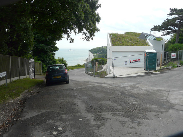
Image: © John Baker Taken: 26 Jun 2016
Compared with Image, all scaffolding has been removed, the exterior walls have been painted, an eco-friendly roof covering has been added and a garage door installed. Planning permission was granted by Dover District Council under application number DOV/11/00127 for the "erection of a detached dwelling (existing dwelling to be demolished)”. The site lies at the junction of Granville Road (to the right) and Hotel Road (to the left).
Images are licensed for reuse under creativecommons.org/licenses/by-sa/2.0
Image Location
Latitude
51.153181
Longitude
1.387213