Mexborough's shortest cycle lane
Introduction
The photograph on this page of Mexborough's shortest cycle lane by David Wilkinson as part of the Geograph project.
The Geograph project started in 2005 with the aim of publishing, organising and preserving representative images for every square kilometre of Great Britain, Ireland and the Isle of Man.

There are currently over 7.5m images from over 14,400 individuals and you can help contribute to the project by visiting https://www.geograph.org.uk
Mexborough's shortest cycle lane
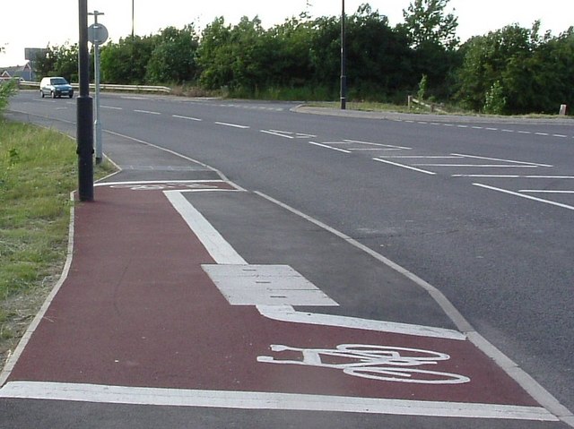
Image: © David Wilkinson Taken: 10 Jun 2004
We're always being told that, to reduce climate change, for short journeys we should consider cycling instead of driving. Well, here is a cycle lane for VERY short journeys, at the north end of Bambury Bridge on the A6023 on the eastern outskirts of Mexborough. The original route of the A6023 followed the turning visible at the far right of this photo across a lower-lying bridge - often subject to flooding - over the River Don, and a level crossing. Bambury Bridge opened in 2001.
Images are licensed for reuse under creativecommons.org/licenses/by-sa/2.0
Image Location


Leaflet Map data © OpenStreetMap
Latitude
53.494431
Longitude
-1.262879