West Howe: footpath U35 becomes Ericksen Road
Introduction
The photograph on this page of West Howe: footpath U35 becomes Ericksen Road by Chris Downer as part of the Geograph project.
The Geograph project started in 2005 with the aim of publishing, organising and preserving representative images for every square kilometre of Great Britain, Ireland and the Isle of Man.

There are currently over 7.5m images from over 14,400 individuals and you can help contribute to the project by visiting https://www.geograph.org.uk
West Howe: footpath U35 becomes Ericksen Road
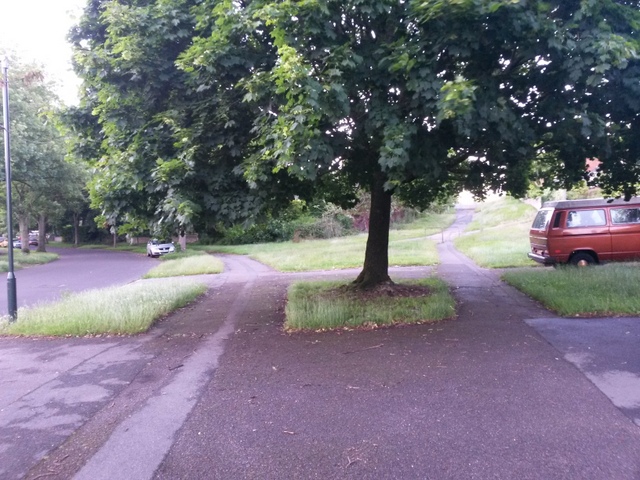
Image: © Chris Downer Taken: 28 Jun 2016
The pavement of Moorside Road swings round to the left, while the public footpath goes to the right of the tree and becomes Ericksen Road, a minor road which has only been tarmacked relatively recently. It leads up to Kinson Road but a barrier prevents vehicles from using it. See Image] for the next view up Ericksen Road, and Image for the continuing public right of way behind us.
Images are licensed for reuse under creativecommons.org/licenses/by-sa/2.0
Image Location
Latitude
50.757884
Longitude
-1.902126