West Howe: footpath U23 to Moorside Close
Introduction
The photograph on this page of West Howe: footpath U23 to Moorside Close by Chris Downer as part of the Geograph project.
The Geograph project started in 2005 with the aim of publishing, organising and preserving representative images for every square kilometre of Great Britain, Ireland and the Isle of Man.

There are currently over 7.5m images from over 14,400 individuals and you can help contribute to the project by visiting https://www.geograph.org.uk
West Howe: footpath U23 to Moorside Close
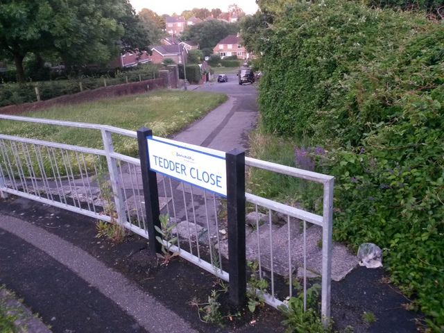
Image: © Chris Downer Taken: 28 Jun 2016
A short path leading from Tedder Road (at the turning of Tedder Close) down to the dead end of Moorside Close - a pedestrian route down onto Moorside Road which we see crossing the picture at the bottom of the hill. A step-free route is available a few yards to the left, at the other end of the railing. See Image for the wider view from behind us, and Image for the view up the path from the Moorside Close end. Before the West Howe estate was built in the 1950s/60s, this was the course of one of the few tracks across this open heathland, following the modern-day Mount Road behind us and continuing ahead, across Moorside Road to Kinson Road.
Images are licensed for reuse under creativecommons.org/licenses/by-sa/2.0
Image Location
Latitude
50.758065
Longitude
-1.903685