Cardross Sawmill
Introduction
The photograph on this page of Cardross Sawmill by Lairich Rig as part of the Geograph project.
The Geograph project started in 2005 with the aim of publishing, organising and preserving representative images for every square kilometre of Great Britain, Ireland and the Isle of Man.

There are currently over 7.5m images from over 14,400 individuals and you can help contribute to the project by visiting https://www.geograph.org.uk
Cardross Sawmill
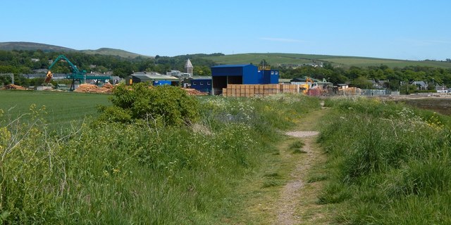
Image: © Lairich Rig Taken: 3 Jun 2016
The picture was taken from a path along the shore at Cardross. The sawmill, properly Ridings Sawmills (Cardross) Ltd, is prominent in this view, with the spire of the present-day Image behind it. Between the log yard and the shore is a walkway, along which the shore path continues: Image and Image One of the footbridges of Image is visible in the right background; compare Image At the far left, in the present picture, is a crane, a quite recent addition, whose manner of operation interested me from a distance. It is a Baljer & Zembrod Portal Crane, installed here in late 2015 or early 2016 when the existing log yard was replaced. The cabin rotates and moves back and forth along the portal (or gantry), while the portal itself moves from side to side on rails. For closer views of the sawmill, see Image and Image
Images are licensed for reuse under creativecommons.org/licenses/by-sa/2.0
Image Location
Latitude
55.960843
Longitude
-4.65647