Red Road at West Lodge
Introduction
The photograph on this page of Red Road at West Lodge by Lairich Rig as part of the Geograph project.
The Geograph project started in 2005 with the aim of publishing, organising and preserving representative images for every square kilometre of Great Britain, Ireland and the Isle of Man.

There are currently over 7.5m images from over 14,400 individuals and you can help contribute to the project by visiting https://www.geograph.org.uk
Red Road at West Lodge
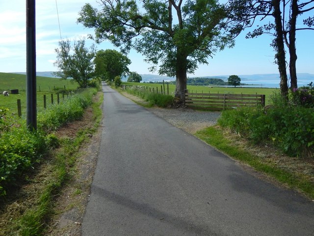
Image: © Lairich Rig Taken: 3 Jun 2016
The path shown in Image meets Red Road beside West Lodge. The present picture is a view of the road from that point, which is the western end of the core path. Red Road itself leads downhill to meet the main road at Image, almost opposite the point (Image) where a road leads down to Ardmore Point. Ardmore Point itself can be seen in this picture, just right of centre, as a wooded promontory, projecting out into the Firth of Clyde.
Images are licensed for reuse under creativecommons.org/licenses/by-sa/2.0
Image Location
Latitude
55.977601
Longitude
-4.675413