Barrhead ROC Bunker: radio aerial cover
Introduction
The photograph on this page of Barrhead ROC Bunker: radio aerial cover by Lairich Rig as part of the Geograph project.
The Geograph project started in 2005 with the aim of publishing, organising and preserving representative images for every square kilometre of Great Britain, Ireland and the Isle of Man.

There are currently over 7.5m images from over 14,400 individuals and you can help contribute to the project by visiting https://www.geograph.org.uk
Barrhead ROC Bunker: radio aerial cover
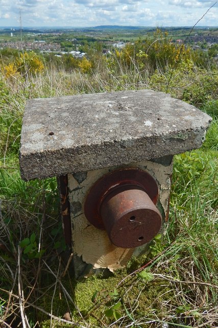
Image: © Lairich Rig Taken: 23 May 2016
The upright structure as a whole is shown in Image; the radio aerial cover is the object that is shown in the present picture as projecting from its near side. For the main description of the remains here, and for a view in context, see Image ROC posts were grouped in clusters, with one master post for each cluster; the presence of a radio aerial here indicates that Barrhead ROC was one such master post.
Images are licensed for reuse under creativecommons.org/licenses/by-sa/2.0
Image Location
Latitude
55.80358
Longitude
-4.406049