Line of old drove road
Introduction
The photograph on this page of Line of old drove road by Lairich Rig as part of the Geograph project.
The Geograph project started in 2005 with the aim of publishing, organising and preserving representative images for every square kilometre of Great Britain, Ireland and the Isle of Man.

There are currently over 7.5m images from over 14,400 individuals and you can help contribute to the project by visiting https://www.geograph.org.uk
Line of old drove road
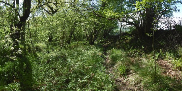
Image: © Lairich Rig Taken: 22 May 2016
This is a view downhill. To the right (north) are a wall and a fence that form the boundary of an adjacent field. To the left is a mound that is an old wall, mostly overgrown with turf. Just beyond it is the present-day path (Image), which is next to a slope leading down to the Pappert Burn. The present picture is a view along what I take to be the line of the old drove road here. The nearby present-day path closely follows the upper edge of the slope leading down to the Murroch Burn, while the older drove road instead consistently follows the edge of the wall that forms the field boundary. For much of its length (specifically, where the burn is not far from the field boundary), the present-day path follows the same line as the old drove road: see Image for an example. Where the burn meanders farther from the field boundary, the current path and the old drove route diverge, as at the point shown here. A view uphill from the same spot included an area that a burn flows through, exposing some stones to view; I found it tempting to see these as a form of paving, though I cannot tell whether they date from the days of droving, or from more recently: Image
Images are licensed for reuse under creativecommons.org/licenses/by-sa/2.0
Image Location
Latitude
55.983591
Longitude
-4.558466