Bournemouth: top of Dalkeith Lane
Introduction
The photograph on this page of Bournemouth: top of Dalkeith Lane by Chris Downer as part of the Geograph project.
The Geograph project started in 2005 with the aim of publishing, organising and preserving representative images for every square kilometre of Great Britain, Ireland and the Isle of Man.

There are currently over 7.5m images from over 14,400 individuals and you can help contribute to the project by visiting https://www.geograph.org.uk
Bournemouth: top of Dalkeith Lane
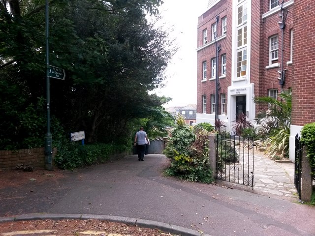
Image: © Chris Downer Taken: 15 Jun 2016
Looking along the start of this public right of way - footpath C04 - from the dead end of Richmond Gardens. The path descends steeply (and, considering the urban location, with something of a rural feel) to meet Old Christchurch Road. See Image for the view towards us from a little way down the path, and links to further photos on the route. Mount Heatherbank is the rather attractive block of flats on the right.
Images are licensed for reuse under creativecommons.org/licenses/by-sa/2.0
Image Location
Latitude
50.72216
Longitude
-1.877126