Bermondsey Health Centre, Grange Road
Introduction
The photograph on this page of Bermondsey Health Centre, Grange Road by Stephen Richards as part of the Geograph project.
The Geograph project started in 2005 with the aim of publishing, organising and preserving representative images for every square kilometre of Great Britain, Ireland and the Isle of Man.

There are currently over 7.5m images from over 14,400 individuals and you can help contribute to the project by visiting https://www.geograph.org.uk
Bermondsey Health Centre, Grange Road
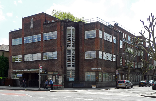
Image: © Stephen Richards Taken: 27 May 2013
By Henry Tansley, Borough Architect, 1936. Bermondsey was a pioneer in health provision. This originally included "infant welfare and ante-natal clinics, rooms for radiotherapy and diathermy (heat treatment using high-frequency electrical current), a foot clinic and a solarium and dispensary for sufferers of TB". (municipaldreams).
Images are licensed for reuse under creativecommons.org/licenses/by-sa/2.0
Image Location
Latitude
51.493499
Longitude
-0.074618