Uplifted railway used as a cycle track and footpath
Introduction
The photograph on this page of Uplifted railway used as a cycle track and footpath by John Haynes as part of the Geograph project.
The Geograph project started in 2005 with the aim of publishing, organising and preserving representative images for every square kilometre of Great Britain, Ireland and the Isle of Man.

There are currently over 7.5m images from over 14,400 individuals and you can help contribute to the project by visiting https://www.geograph.org.uk
Uplifted railway used as a cycle track and footpath
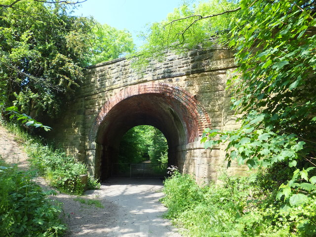
Image: © John Haynes Taken: 6 Jun 2016
The skewed bridge was built to take the single track railway under the road. The curving and skewed brickwork is a great reflection on the skills of the Victorian bricklayers. https://en.wikipedia.org/wiki/Wrexham_and_Minera_Railway
Images are licensed for reuse under creativecommons.org/licenses/by-sa/2.0
Image Location
Latitude
53.051662
Longitude
-3.024258