Three Tuns House, High Street, Steyning
Introduction
The photograph on this page of Three Tuns House, High Street, Steyning by Simon Carey as part of the Geograph project.
The Geograph project started in 2005 with the aim of publishing, organising and preserving representative images for every square kilometre of Great Britain, Ireland and the Isle of Man.

There are currently over 7.5m images from over 14,400 individuals and you can help contribute to the project by visiting https://www.geograph.org.uk
Three Tuns House, High Street, Steyning
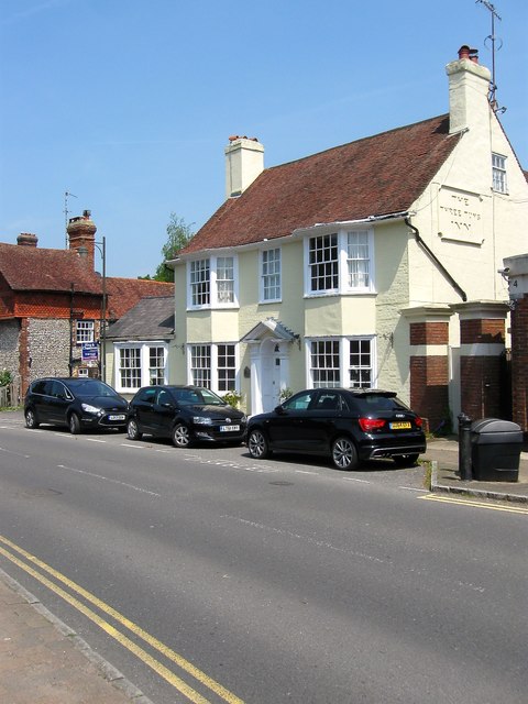
Image: © Simon Carey Taken: 29 May 2016
The building dates from the 18th century and was the brewery tap for neighbouring Gates's Brewery which is marked on the 1876 OS map as Three Tuns brewery. The brewery closed in the late 1920s and most of the former buildings were demolished. However, the Three Tuns survived into the 1980s but I'm not sure when it finally closed. The former inn has been divided into a couple of residential dwellings.
Images are licensed for reuse under creativecommons.org/licenses/by-sa/2.0
Image Location
Latitude
50.886845
Longitude
-0.326509