Information board for The Church of Our Lady of the Angels and St. Winefride
Introduction
The photograph on this page of Information board for The Church of Our Lady of the Angels and St. Winefride by John Lucas as part of the Geograph project.
The Geograph project started in 2005 with the aim of publishing, organising and preserving representative images for every square kilometre of Great Britain, Ireland and the Isle of Man.

There are currently over 7.5m images from over 14,400 individuals and you can help contribute to the project by visiting https://www.geograph.org.uk
Information board for The Church of Our Lady of the Angels and St. Winefride
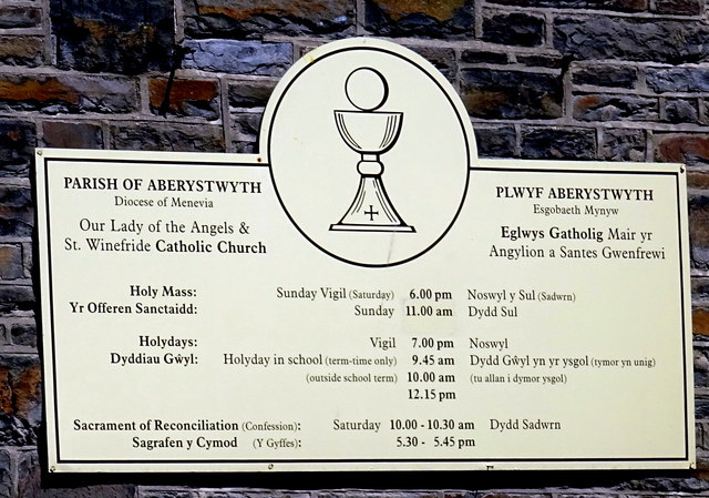
Image: © John Lucas Taken: 2 Jun 2016
Now sadly irrelevant for the church is closed and barricaded. See also Image
Images are licensed for reuse under creativecommons.org/licenses/by-sa/2.0
Image Location
Latitude
52.418961
Longitude
-4.083449