Cefn Gelligaer
Introduction
The photograph on this page of Cefn Gelligaer by Alan Richards as part of the Geograph project.
The Geograph project started in 2005 with the aim of publishing, organising and preserving representative images for every square kilometre of Great Britain, Ireland and the Isle of Man.

There are currently over 7.5m images from over 14,400 individuals and you can help contribute to the project by visiting https://www.geograph.org.uk
Cefn Gelligaer
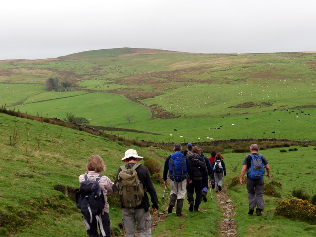
Image: © Alan Richards Taken: 9 Oct 2011
Cerddwyr yn mynd im lawr y waered tuag at yr heol fach ar Gefn Gelligaer. Walkers descending the hill towards a minor road on Cefn Gelligaer (trans. fort of the grove ridge).
Images are licensed for reuse under creativecommons.org/licenses/by-sa/2.0
Image Location
Latitude
51.707743
Longitude
-3.291174