Bangor from Ballymacormick Point
Introduction
The photograph on this page of Bangor from Ballymacormick Point by Rossographer as part of the Geograph project.
The Geograph project started in 2005 with the aim of publishing, organising and preserving representative images for every square kilometre of Great Britain, Ireland and the Isle of Man.

There are currently over 7.5m images from over 14,400 individuals and you can help contribute to the project by visiting https://www.geograph.org.uk
Bangor from Ballymacormick Point
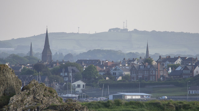
Image: © Rossographer Taken: 28 May 2016
A telephoto shot towards Bangor from Ballymacormick Point. The rock and grass in the foreground is close to the camera position; part of Ballyholme Yacht Club Image is seen about 2km away; the tallest of the three prominent church spires in the town centre belongs to St Comgall's Image; the summit of Cairngaver can be seen in the far distance with the communication masts atop Image
Images are licensed for reuse under creativecommons.org/licenses/by-sa/2.0
Image Location
Latitude
54.665855
Longitude
-5.652992