Site of St Martin Outwich church, east end of Threadneedle Street EC2
Introduction
The photograph on this page of Site of St Martin Outwich church, east end of Threadneedle Street EC2 by Christopher Hilton as part of the Geograph project.
The Geograph project started in 2005 with the aim of publishing, organising and preserving representative images for every square kilometre of Great Britain, Ireland and the Isle of Man.

There are currently over 7.5m images from over 14,400 individuals and you can help contribute to the project by visiting https://www.geograph.org.uk
Site of St Martin Outwich church, east end of Threadneedle Street EC2
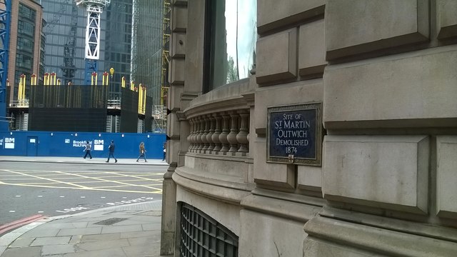
Image: © Christopher Hilton Taken: 27 May 2016
St Martin Outwich, one of the many parish churches of medieval London, survived the Great Fire in 1666 but was damaged by fire a century later; dilapidated, it was rebuilt at the end of the eighteenth century to an unusual oval plan. It was demolished in 1874, the Victorian period seeing another great cull of churches, this time on the grounds of shrinking population rendering them redundant. See https://en.wikipedia.org/wiki/St_Martin_Outwich for more information.
Images are licensed for reuse under creativecommons.org/licenses/by-sa/2.0
Image Location
Latitude
51.514245
Longitude
-0.083976