Bridge abutments south of Moffat
Introduction
The photograph on this page of Bridge abutments south of Moffat by Richard Law as part of the Geograph project.
The Geograph project started in 2005 with the aim of publishing, organising and preserving representative images for every square kilometre of Great Britain, Ireland and the Isle of Man.

There are currently over 7.5m images from over 14,400 individuals and you can help contribute to the project by visiting https://www.geograph.org.uk
Bridge abutments south of Moffat
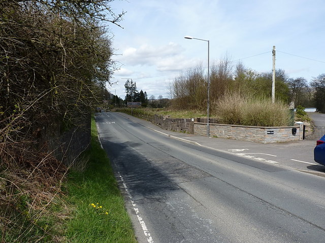
Image: © Richard Law Taken: 24 Apr 2016
The low wall just beyond the streetlamp is the all that remains on the east side of the A701 of the abutment of the bridge that carried the Beattock to Moffat branch line into the southern side of the town. This was originally a couple of miles long, serving only Moffat Station, and was built in the early 1880s, closing to passengers in 1954, and to goods traffic in 1964. A rather larger abutment survives on the other side of the road, just visible here under the overhanging vegetation.
Images are licensed for reuse under creativecommons.org/licenses/by-sa/2.0
Image Location
Latitude
55.32159
Longitude
-3.445711