Converted chapel, Cliburn
Introduction
The photograph on this page of Converted chapel, Cliburn by Richard Vince as part of the Geograph project.
The Geograph project started in 2005 with the aim of publishing, organising and preserving representative images for every square kilometre of Great Britain, Ireland and the Isle of Man.

There are currently over 7.5m images from over 14,400 individuals and you can help contribute to the project by visiting https://www.geograph.org.uk
Converted chapel, Cliburn
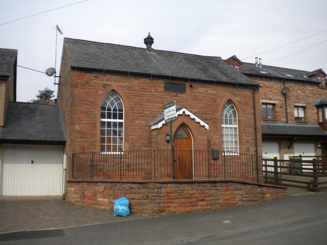
Image: © Richard Vince Taken: 11 Apr 2016
The inscription above the porch reads "WESLEYAN CHAPEL 1852"; however, it appears to have been in residential use for some time.
Images are licensed for reuse under creativecommons.org/licenses/by-sa/2.0
Image Location
Latitude
54.616836
Longitude
-2.640122