Canada Estate, Lower Road (1)
Introduction
The photograph on this page of Canada Estate, Lower Road (1) by Stephen Richards as part of the Geograph project.
The Geograph project started in 2005 with the aim of publishing, organising and preserving representative images for every square kilometre of Great Britain, Ireland and the Isle of Man.

There are currently over 7.5m images from over 14,400 individuals and you can help contribute to the project by visiting https://www.geograph.org.uk
Canada Estate, Lower Road (1)
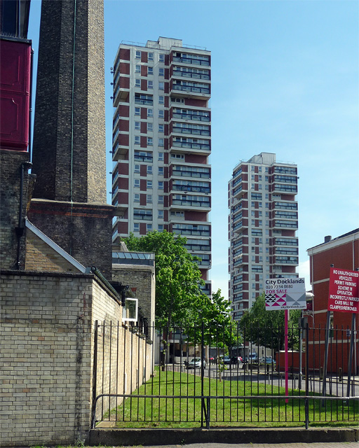
Image: © Stephen Richards Taken: 26 May 2013
By the London County Council's Architect's Department, 1962-64. The distinctive form of the two twenty-one storey point blocks (Regina and Columbia) was widely employed in London at the time (e.g. Image]). On the left is the chimney of Image
Images are licensed for reuse under creativecommons.org/licenses/by-sa/2.0
Image Location
Latitude
51.498144
Longitude
-0.050938