Arosfa Hotel, 10-16, Lower Church Road
Introduction
The photograph on this page of Arosfa Hotel, 10-16, Lower Church Road by John Baker as part of the Geograph project.
The Geograph project started in 2005 with the aim of publishing, organising and preserving representative images for every square kilometre of Great Britain, Ireland and the Isle of Man.

There are currently over 7.5m images from over 14,400 individuals and you can help contribute to the project by visiting https://www.geograph.org.uk
Arosfa Hotel, 10-16, Lower Church Road
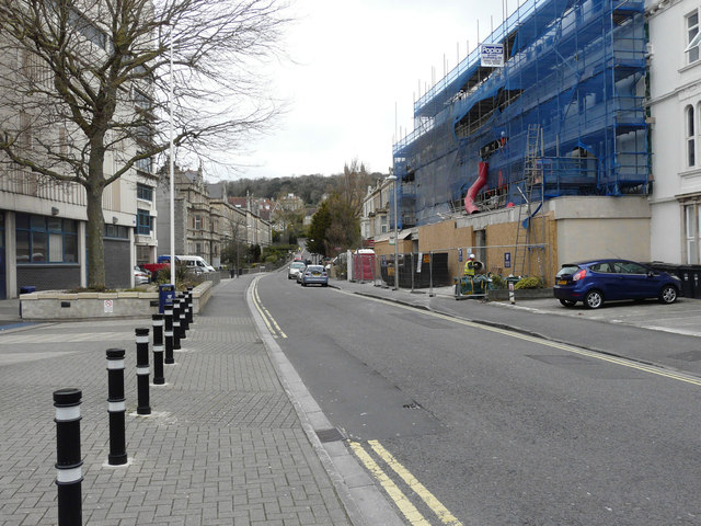
Image: © John Baker Taken: 7 Apr 2016
The ongoing building work, here hidden under scaffolding and blue safety netting, is described in North Somerset Council’s planning application 16/P/0241/F as the “change of use of existing hotel (C1) to residential college (C2). Erection of a single storey front extension following the demolition of the existing single storey frontage, external alterations to include: raising the roof height of the first floor rear”.
Images are licensed for reuse under creativecommons.org/licenses/by-sa/2.0
Image Location
Latitude
51.351075
Longitude
-2.980852