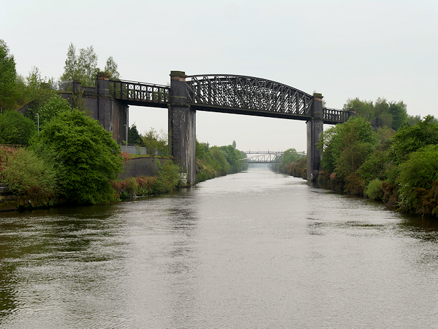
Latchford Railway Viaduct (Disused)
Introduction
The photograph on this page of Latchford Railway Viaduct (Disused) by David Dixon as part of the Geograph project.
The Geograph project started in 2005 with the aim of publishing, organising and preserving representative images for every square kilometre of Great Britain, Ireland and the Isle of Man.
There are currently over 7.5m images from over 14,400 individuals and you can help contribute to the project by visiting https://www.geograph.org.uk

Image: © David Dixon Taken: 11 May 2016
Latchford viaduct was opened on 8 July 1893 to carry the London and North Western Railway's Stockport to Warrington line over the Manchester Ship Canal. Passenger services ended in 1962 but the line continued to carry freight until It finally closed to all traffic in July 1985, when the extensive repairs to keep Latchford viaduct operational were deemed too costly to make. Much of the railway line is now used for the Trans Pennine Trail, footpath and bridle-path, but it has to deviate away from the railway line because the bridge is no longer considered safe and is sealed at both ends to keep trespassers off.

