House at the end of Chapel Street
Introduction
The photograph on this page of House at the end of Chapel Street by Alan Murray-Rust as part of the Geograph project.
The Geograph project started in 2005 with the aim of publishing, organising and preserving representative images for every square kilometre of Great Britain, Ireland and the Isle of Man.

There are currently over 7.5m images from over 14,400 individuals and you can help contribute to the project by visiting https://www.geograph.org.uk
House at the end of Chapel Street
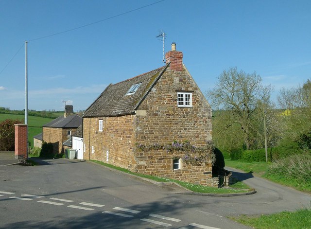
Image: © Alan Murray-Rust Taken: 8 May 2016
A datestone in the gable end carries the date 1758. Coursed stone rubble with stone tile roof, Listed Grade II.
Images are licensed for reuse under creativecommons.org/licenses/by-sa/2.0
Image Location
Latitude
52.605057
Longitude
-0.794585