Chinnor Windmill
Introduction
The photograph on this page of Chinnor Windmill by Chris Allen as part of the Geograph project.
The Geograph project started in 2005 with the aim of publishing, organising and preserving representative images for every square kilometre of Great Britain, Ireland and the Isle of Man.

There are currently over 7.5m images from over 14,400 individuals and you can help contribute to the project by visiting https://www.geograph.org.uk
Chinnor Windmill
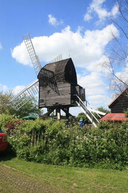
Image: © Chris Allen Taken: 15 May 2016
This is a reconstruction of a post mill that has been moved from across the road where it had been allowed to collapse and its site subsequently built upon. The original possibly dates from 1789 and remained in use until 1923 when it was damaged by strong winds, It was then left to decay and recovered in 1967 when it had to be removed to make way for a housing estate. It has been painstakingly reconstructed but most of the original fabric has had to be replaced.
Images are licensed for reuse under creativecommons.org/licenses/by-sa/2.0
Image Location
Latitude
51.703641
Longitude
-0.916369