Huntspill River
Introduction
The photograph on this page of Huntspill River by Derek Harper as part of the Geograph project.
The Geograph project started in 2005 with the aim of publishing, organising and preserving representative images for every square kilometre of Great Britain, Ireland and the Isle of Man.

There are currently over 7.5m images from over 14,400 individuals and you can help contribute to the project by visiting https://www.geograph.org.uk
Huntspill River
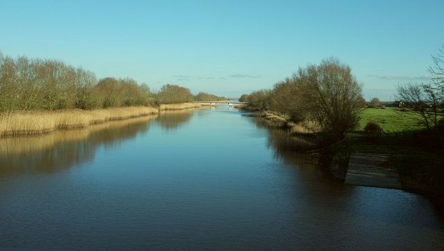
Image: © Derek Harper Taken: 24 Feb 2016
From the M5 bridge, looking upstream. On the right is one of four slipways symmetrically placed about the bridge, and doubtless related to its construction or maintenance. The artificial river was built in 1940 to supply the 4.5 million gallons of water required daily by the Royal Ordnance Factory near Puriton. Nearly 500 metres away is Withy Drove Bridge, connecting a pumping station, Withy Farm and Rookery Farm on the south side to the outside world.
Images are licensed for reuse under creativecommons.org/licenses/by-sa/2.0
Image Location
Latitude
51.193005
Longitude
-2.968762