Ruined Pavilion in Wallingwells Castle Garden
Introduction
The photograph on this page of Ruined Pavilion in Wallingwells Castle Garden by Jonathan Clitheroe as part of the Geograph project.
The Geograph project started in 2005 with the aim of publishing, organising and preserving representative images for every square kilometre of Great Britain, Ireland and the Isle of Man.

There are currently over 7.5m images from over 14,400 individuals and you can help contribute to the project by visiting https://www.geograph.org.uk
Ruined Pavilion in Wallingwells Castle Garden
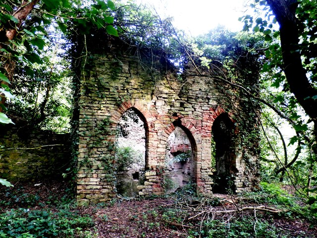
Image: © Jonathan Clitheroe Taken: 7 May 2016
3-storey embattled pavilion situated in the south east corner of a walled garden, now heavily overgrown. There is a lower floor not visible here which opens out into a disused quarry to the right. The site is Grade II-listed.
Images are licensed for reuse under creativecommons.org/licenses/by-sa/2.0
Image Location
Latitude
53.353866
Longitude
-1.144513