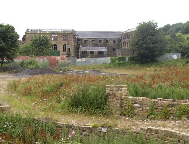
Westwood Mills, Low Westwood, Golcar
Introduction
The photograph on this page of Westwood Mills, Low Westwood, Golcar by Humphrey Bolton as part of the Geograph project.
The Geograph project started in 2005 with the aim of publishing, organising and preserving representative images for every square kilometre of Great Britain, Ireland and the Isle of Man.
There are currently over 7.5m images from over 14,400 individuals and you can help contribute to the project by visiting https://www.geograph.org.uk

Image: © Humphrey Bolton Taken: 12 Jul 2007
These buildings are fully described in three entries in the imagesofengland site, but when searching be aware that the buildings have been incorrectly described as being in Linthwaite, which of course is on the south side of the river. On the right the 'East Block' is an early 19C warehouse and workshop range. In the south elevation, to the mill yard, there are taking-in doors in the centre of the two upper floors. The east gable, shown on Alan Longbottom's monochrome photograph, have mullioned windows altered to form loading doors to each storey. The 'West Block' in the centre of the view was an earlier fulling and scribbling mill, built by John Shaw c.1800. It has an opening for the mill race on the far side. The water-wheel was replaced by an 85hp. Gunther & Son water turbine in 1920. The smaller building in front housed the offices and a workshop.

