Missing public footpath by Cornelly Quarry
Introduction
The photograph on this page of Missing public footpath by Cornelly Quarry by eswales as part of the Geograph project.
The Geograph project started in 2005 with the aim of publishing, organising and preserving representative images for every square kilometre of Great Britain, Ireland and the Isle of Man.

There are currently over 7.5m images from over 14,400 individuals and you can help contribute to the project by visiting https://www.geograph.org.uk
Missing public footpath by Cornelly Quarry
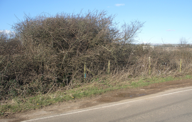
Image: © eswales Taken: 24 Feb 2016
This is the spot where a public footpath at the west side of Cornelly Quarry is shown meeting Mount Pleasant Road on Ordnance Survey maps. There is, however, no sign of such a junction here or, for that matter, at adjacent parts of Mount Pleasant Road.
Images are licensed for reuse under creativecommons.org/licenses/by-sa/2.0
Image Location


Leaflet Map data © OpenStreetMap
Latitude
51.504277
Longitude
-3.68626