Portland Street, Mansfield, Notts.
Introduction
The photograph on this page of Portland Street, Mansfield, Notts. by David Hallam-Jones as part of the Geograph project.
The Geograph project started in 2005 with the aim of publishing, organising and preserving representative images for every square kilometre of Great Britain, Ireland and the Isle of Man.

There are currently over 7.5m images from over 14,400 individuals and you can help contribute to the project by visiting https://www.geograph.org.uk
Portland Street, Mansfield, Notts.
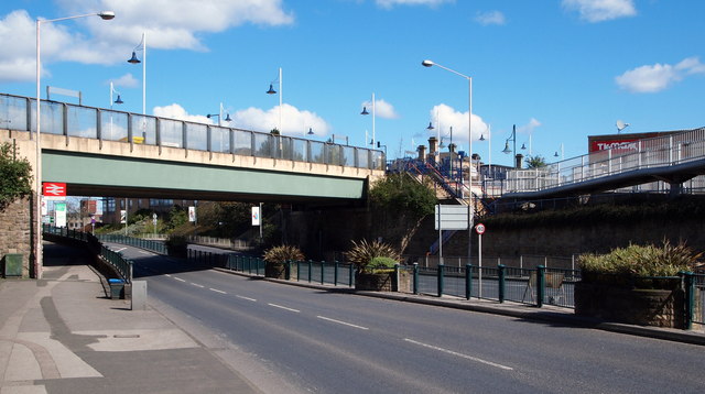
Image: © David Hallam-Jones Taken: 17 Apr 2016
The Belvedere Street/Portland Street railway bridge seen here carries rail traffic on the Robin Hood Line in and out of Mansfield Station. Apart from the stone steps that pedestrians can use between the elevated station and the southbound side of the carriageway, a section of the futuristic Gateway footbridge - from which this photo was taken - can be seen in front of the TK Maxx retail outlet. Gateway Bridge links the Portland Sidings Retail Park (behind the photographer) with the town centre (on the right).
Images are licensed for reuse under creativecommons.org/licenses/by-sa/2.0
Image Location
Latitude
53.141388
Longitude
-1.199569