Bus turning circle, Tile Hill South (2)
Introduction
The photograph on this page of Bus turning circle, Tile Hill South (2) by Richard Vince as part of the Geograph project.
The Geograph project started in 2005 with the aim of publishing, organising and preserving representative images for every square kilometre of Great Britain, Ireland and the Isle of Man.

There are currently over 7.5m images from over 14,400 individuals and you can help contribute to the project by visiting https://www.geograph.org.uk
Bus turning circle, Tile Hill South (2)
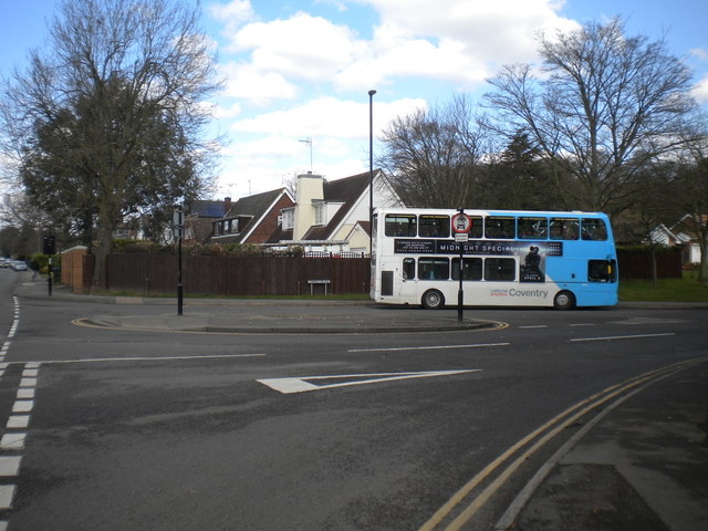
Image: © Richard Vince Taken: 2 Apr 2016
Built into the junction of Torrington Avenue (foreground) and Station Avenue (just visible on the left), this turning circle is currently the terminus of routes 5, 18 (on which the bus visible here is operating), and 18A. Despite being close to the west end of Tile Hill, buses terminating here have always shown Tile Hill South, presumably to differentiate them from those terminating at Tile Hill North (see Image).
Images are licensed for reuse under creativecommons.org/licenses/by-sa/2.0
Image Location
Latitude
52.397884
Longitude
-1.595206