Church Farmhouse, Barrowden
Introduction
The photograph on this page of Church Farmhouse, Barrowden by Alan Murray-Rust as part of the Geograph project.
The Geograph project started in 2005 with the aim of publishing, organising and preserving representative images for every square kilometre of Great Britain, Ireland and the Isle of Man.

There are currently over 7.5m images from over 14,400 individuals and you can help contribute to the project by visiting https://www.geograph.org.uk
Church Farmhouse, Barrowden
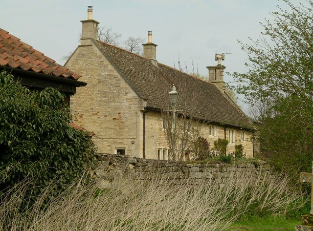
Image: © Alan Murray-Rust Taken: 11 Apr 2016
Much restored in the 20th century, the house incorporates stones dated 1586 and 1648; coursed stone rubble with Collyweston stone slate roof, Listed Grade II. View from the churchyard.
Images are licensed for reuse under creativecommons.org/licenses/by-sa/2.0
Image Location
Latitude
52.589238
Longitude
-0.606512