Radar tower and hut at the end of the runway
Introduction
The photograph on this page of Radar tower and hut at the end of the runway by Richard Law as part of the Geograph project.
The Geograph project started in 2005 with the aim of publishing, organising and preserving representative images for every square kilometre of Great Britain, Ireland and the Isle of Man.

There are currently over 7.5m images from over 14,400 individuals and you can help contribute to the project by visiting https://www.geograph.org.uk
Radar tower and hut at the end of the runway
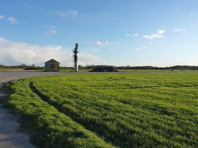
Image: © Richard Law Taken: 6 Apr 2016
Following the end of the war, RAF Rivenhall Aerodrome fell into disuse as an active aircraft base, and went into care and maintenance in 1946. It remained as a reserve field until the mid 1950s, and was then leased to Marconi for radar testing and development. This ceased in about 2005, and the land is currently being restored, gradually, to agricultural use by removing and recycling the heavy bomber runways and hardstandings. This construction at the eastern end of the main runway is one of the remaining radar installations, but may not last much longer as the runway is excavated and broken up.
Images are licensed for reuse under creativecommons.org/licenses/by-sa/2.0
Image Location
Latitude
51.856181
Longitude
0.658088