Ford Place from the south
Introduction
The photograph on this page of Ford Place from the south by Marathon as part of the Geograph project.
The Geograph project started in 2005 with the aim of publishing, organising and preserving representative images for every square kilometre of Great Britain, Ireland and the Isle of Man.

There are currently over 7.5m images from over 14,400 individuals and you can help contribute to the project by visiting https://www.geograph.org.uk
Ford Place from the south
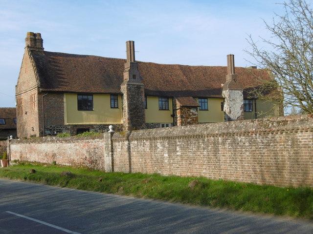
Image: © Marathon Taken: 10 Apr 2016
Ford Place consists of one wing of a large Elizabethan or Jacobean mansion. According to John Newman in Pevsner's "The Buildings of England: West Kent and The Weald" the plan must have been a half-H of which the centre and north wing have disappeared. He points out that on the chimney stacks are the dates 1582 and 1605, although the numerals are 20th century. For the view of the north side see http://www.geograph.org.uk/photo/4903682
Images are licensed for reuse under creativecommons.org/licenses/by-sa/2.0
Image Location
Latitude
51.302733
Longitude
0.346061