Glenridding from Side Farm
Introduction
The photograph on this page of Glenridding from Side Farm by Mick Garratt as part of the Geograph project.
The Geograph project started in 2005 with the aim of publishing, organising and preserving representative images for every square kilometre of Great Britain, Ireland and the Isle of Man.

There are currently over 7.5m images from over 14,400 individuals and you can help contribute to the project by visiting https://www.geograph.org.uk
Glenridding from Side Farm
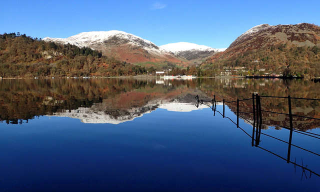
Image: © Mick Garratt Taken: 10 Apr 2016
I fell asleep last night to the pitter patter of rain on the tent. I find that somewhat soporific. This morning the tent flap was frozen solid and a shower of frost fell as I forced it open. Outside was cloudless and the sun was already shining across Ullswater onto the fells of Birkhouse Moor, Raise and Sheffield Pike, topped with fresh snow. It was going to be a cracking day.
Images are licensed for reuse under creativecommons.org/licenses/by-sa/2.0
Image Location
Latitude
54.543717
Longitude
-2.949369