Maryhill Burgh Hall
Introduction
The photograph on this page of Maryhill Burgh Hall by Thomas Nugent as part of the Geograph project.
The Geograph project started in 2005 with the aim of publishing, organising and preserving representative images for every square kilometre of Great Britain, Ireland and the Isle of Man.

There are currently over 7.5m images from over 14,400 individuals and you can help contribute to the project by visiting https://www.geograph.org.uk
Maryhill Burgh Hall
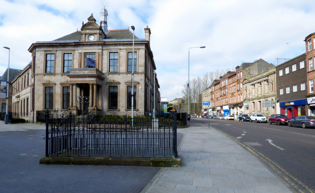
Image: © Thomas Nugent Taken: 19 Mar 2016
A Category B Listed building http://portal.historic-scotland.gov.uk/designation/LB32349 off Maryhill Road at Gairbraid Avenue. What appears to be the blocked-up entrance to a former public toilet is in the foreground.
Images are licensed for reuse under creativecommons.org/licenses/by-sa/2.0
Image Location
Latitude
55.890717
Longitude
-4.290692