Methodist dates
Introduction
The photograph on this page of Methodist dates by Neil Owen as part of the Geograph project.
The Geograph project started in 2005 with the aim of publishing, organising and preserving representative images for every square kilometre of Great Britain, Ireland and the Isle of Man.

There are currently over 7.5m images from over 14,400 individuals and you can help contribute to the project by visiting https://www.geograph.org.uk
Methodist dates
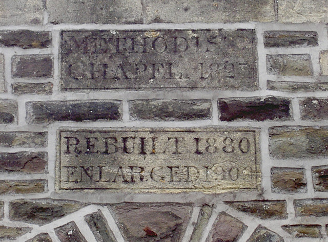
Image: © Neil Owen Taken: 30 Mar 2016
The church in Farrington Gurney has had plenty of other extensions in its time.
Images are licensed for reuse under creativecommons.org/licenses/by-sa/2.0
Image Location
Latitude
51.298665
Longitude
-2.534087