Porthcawl branch line trackbed, South Cornelly
Introduction
The photograph on this page of Porthcawl branch line trackbed, South Cornelly by eswales as part of the Geograph project.
The Geograph project started in 2005 with the aim of publishing, organising and preserving representative images for every square kilometre of Great Britain, Ireland and the Isle of Man.

There are currently over 7.5m images from over 14,400 individuals and you can help contribute to the project by visiting https://www.geograph.org.uk
Porthcawl branch line trackbed, South Cornelly
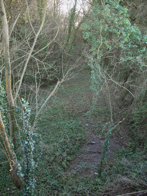
Image: © eswales Taken: 24 Feb 2016
A surviving stretch of trackbed of the long-dismantled Pyle to Porthcawl branch line which closed to all traffic in 1965. At one time, the Dyffryn Llynfi and Porthcawl Railway ran here. The picture was taken on the bridge at the western end of the lane Heol-y-Splot which runs to Cornelly Quarry from the roundabout at the southern end of the village.
Images are licensed for reuse under creativecommons.org/licenses/by-sa/2.0
Image Location
Latitude
51.505957
Longitude
-3.700732