Dorking General Hospital
Introduction
The photograph on this page of Dorking General Hospital by James 'Dan' Hall as part of the Geograph project.
The Geograph project started in 2005 with the aim of publishing, organising and preserving representative images for every square kilometre of Great Britain, Ireland and the Isle of Man.

There are currently over 7.5m images from over 14,400 individuals and you can help contribute to the project by visiting https://www.geograph.org.uk
Dorking General Hospital
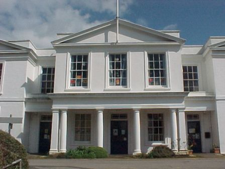
Image: © James 'Dan' Hall Taken: Unknown
Originally the Dorking Union Workhouse, it became a hospital in the Second World War, much extended under the NHS after 1948, it is now known as Dorking General Hospital, and is undergoing major refurbishment although a quarter of it is derelict and due for demolition.
Images are licensed for reuse under creativecommons.org/licenses/by-sa/2.0
Image Location
Latitude
51.225613
Longitude
-0.333013