Charnwood Street
Introduction
The photograph on this page of Charnwood Street by Alan Walker as part of the Geograph project.
The Geograph project started in 2005 with the aim of publishing, organising and preserving representative images for every square kilometre of Great Britain, Ireland and the Isle of Man.

There are currently over 7.5m images from over 14,400 individuals and you can help contribute to the project by visiting https://www.geograph.org.uk
Charnwood Street
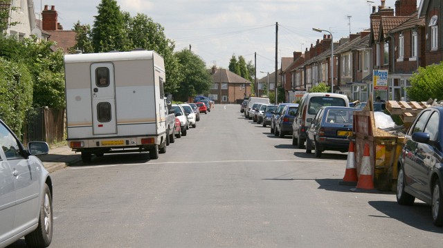
Image: © Alan Walker Taken: 29 Jun 2007
This east south-easterly facing photograph of Charnwood Street (a cul-de-sac) is looking toward its junction with Image Behind the viewpoint, the street terminates in open land with a cycle/footpath route and a recreation ground. The roadway is reasonably wide for one of the period but the parked cars show the problem associated with housing built before the owning of motor vehicles became pluralistic and commonplace. For another photograph of Charnwood Street, taken from a few metres ahead, but looking more toward the houses on the right of this picture, click here: Image For another photograph of Charnwood Street, taken from a few metres ahead, but looking back, beyond this viewpoint, click here: Image
Images are licensed for reuse under creativecommons.org/licenses/by-sa/2.0
Image Location
Latitude
53.121055
Longitude
-1.281533