
Former Ulster Bank, Lisburn Road, Belfast (March 2016)
Introduction
The photograph on this page of Former Ulster Bank, Lisburn Road, Belfast (March 2016) by Albert Bridge as part of the Geograph project.
The Geograph project started in 2005 with the aim of publishing, organising and preserving representative images for every square kilometre of Great Britain, Ireland and the Isle of Man.

There are currently over 7.5m images from over 14,400 individuals and you can help contribute to the project by visiting https://www.geograph.org.uk
Former Ulster Bank, Lisburn Road, Belfast (March 2016)
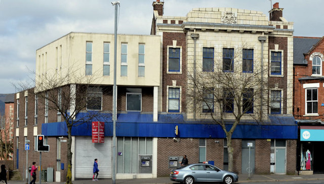
Image: © Albert Bridge Taken: 20 Mar 2016
The closed branch of the Ulster Bank at 185-189 Lisburn Road, now offered for sale. The agents’ description includes “The subject property comprises a three storey traditional bank building with a pitched roof which was significantly extended in the c.1970s to provide a three storey flat roof addition” and “The property is designated as being within an ‘Area of Townscape Character’ and also a “shopping/commercial” area within the Belfast Metropolitan Area Plan 2015. It would therefore be suitable for a variety of uses or for redevelopment, subject to any necessary consents. Interested parties should make their own further enquiries directly with the local Planning Office.”. The building has been substantially extended and altered. Only the upper floors (upper right) remain from the original building. See also Image (June 2009). This photograph appears as a matter of record only. I have no connection with any of the parties involved in the sale.
Images are licensed for reuse under creativecommons.org/licenses/by-sa/2.0
Image Location

Latitude
54.582506
Longitude
-5.946448