Bishop Sutton Mill
Introduction
The photograph on this page of Bishop Sutton Mill by Neil Owen as part of the Geograph project.
The Geograph project started in 2005 with the aim of publishing, organising and preserving representative images for every square kilometre of Great Britain, Ireland and the Isle of Man.

There are currently over 7.5m images from over 14,400 individuals and you can help contribute to the project by visiting https://www.geograph.org.uk
Bishop Sutton Mill
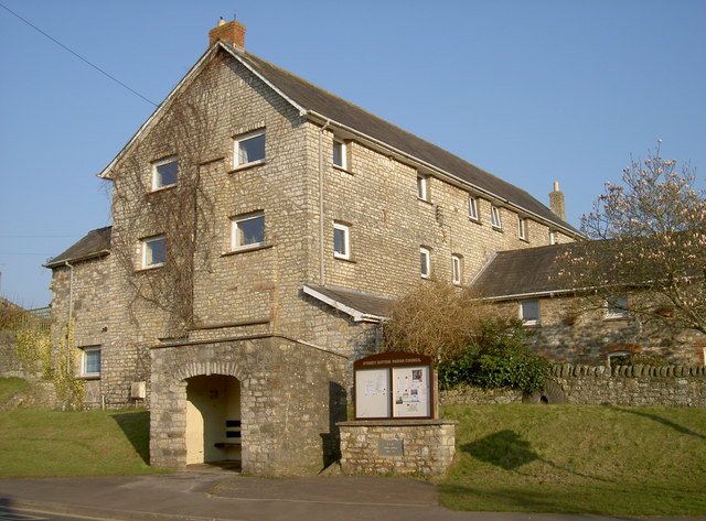
Image: © Neil Owen Taken: 17 Mar 2016
Once this impressive mill was the main grinding mill for flour in Bishop Sutton. It appears to have been built after the main Sutton Top Pit coal mine was sunk and subsequently closed right behind it. By the late nineteenth century it was powered by a steam engine, but there is little evidence that it was an older mill or had used other forms of power. By the outbreak of WWII it had fallen from flour production and in the post-war period had become pretty derelict. It was extensively renovated and converted into flats. Outside, a bus shelter and notice board were built, bearing the Silver Jubilee mark.
Images are licensed for reuse under creativecommons.org/licenses/by-sa/2.0
Image Location
Latitude
51.335422
Longitude
-2.59423