Fecit Farm with Fecit End Delf behind
Introduction
The photograph on this page of Fecit Farm with Fecit End Delf behind by Mike Lee as part of the Geograph project.
The Geograph project started in 2005 with the aim of publishing, organising and preserving representative images for every square kilometre of Great Britain, Ireland and the Isle of Man.

There are currently over 7.5m images from over 14,400 individuals and you can help contribute to the project by visiting https://www.geograph.org.uk
Fecit Farm with Fecit End Delf behind
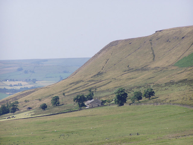
Image: © Mike Lee Taken: 12 Jul 2003
Fecit End Delf is a disused quarry on the edge of the Scout Moor escarpment. The dark band running down the edge of the hill and continuing off the left hand side of the picture is waste stone tipped from the quarry.
Images are licensed for reuse under creativecommons.org/licenses/by-sa/2.0
Image Location
Latitude
53.655031
Longitude
-2.273974